


Étape 2 GTMC mont Aigoual

lorenzot54
User

Length
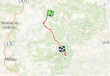
42 km

Max alt
1561 m

Uphill gradient
1605 m
Km-Effort
60 km

Min alt
464 m

Downhill gradient
525 m
Boucle
No
Creation date :
2020-07-07 06:24:00.0
Updated on :
2020-07-07 13:34:57.509
3h58
Difficulty : Unknown

FREE GPS app for hiking
 SityTrail
IGN / Geographical institutes
SityTrail Plus
The world is yours!
About
Trail Mountain bike of 42 km to be discovered at Occitania, Lozère, Gorges du Tarn Causses. This trail is proposed by lorenzot54.
Positioning
Country:
France
Region :
Occitania
Department/Province :
Lozère
Municipality :
Gorges du Tarn Causses
Location:
Sainte-Enimie
Start:(Dec)
Start:(UTM)
531786 ; 4911089 (31T) N.
Comments